Tasking
By Ground
Depending on the type of event, a ground level damage assessment can be the most accurate, especially if there are no aerial assets available and the affected area is small, like in a tornado or fire. When conducting a PDA by ground it is vital to divide the damage area up so that personnel can be sent to the right areas and duplication of effort does not occur. In the United States, if the affected area is more than a square mile, it is helpful to divide the area using the US National Grid (USNG) which is also called the MGRS. Each USNG cell is 1k sq km. Depending on the residential density, a 1k sq km grid cell can be conducted by foot in about an two to four hours time. If debris is cleared from the roads, a car with at least three people (one driver, two assessors on each side of the car) can conduct a PDA in an hour. For reference, the Joplin tornado in 2011 caused damage in about 12 USNG cells.
Often times emergency managers do not know the exact area. This is why the USNG designation helps, because a group or an individual can be sent to assess a range of cells and move to the next cell systematically.
By Air
If conducting by air, it is much easier to deploy aerial assets than deploy personnel by ground. CAP requires as little as a longitude and latitude of a location to be deployed. If the event was a tornado the pilot will be able to recognize the affected area quickly. For flooding events, aerial collection is the only option. When dealing with a flood, it is important to task the pilots to take multiple passes along the flood banks and try to capture as many roof tops as possible. Flood tasking can often require multiple tasking requests if the first pass missed affected homes.
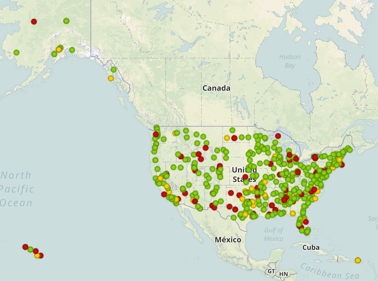
 Civil Air Patrol aircraft nationwide (disregard symbology, the colors refer to the operational status of the aircraft at the time of writing).
One GIS product that often helps in a flood PDA is NGA's Flood Extent shapefile.
As mentioned earlier, it is fair to say that CAP can be over any area in the US within about two hours from lift off. It helps to put CAP on alert if a tornado or flood alerts are issued by the National Weather Service. This way they can assign on call pilots and photographers in case a deployment is requested.
When deploying Urban Search and Rescue, they will use the USNG/MGRS system. However pilots will only use lat/long coordinates.
Useful NWS Tornado PDA Map: http://1.usa.gov/1RpRAep USNG Web App: http://usngapp.org/ USNG Website: http://usngcenter.org/